Grasp the movement of people with a smartphone with free Wi-Fi connection and calculate the population density of 1 m square
"People flow data" on smartphones has become indispensable for grasping the population staying around stations and towns in Korona-ka. The research group of Professor Akihiro Sato of the Graduate School of Data Science, Yokohama City University and Kokusai Kogyo uses the location information recorded when the smartphone automatically detects free Wi-Fi in the city, and the population per 1 m2. We succeeded in calculating the density (estimated number of people).
Changes in the active population within a 1km radius of Shibuya Station in 2019, 20 and 21. Obtained from human flow data based on free Wi-Fi connection information (Source: Kokusai Kogyo) [Click the image to enlarge]People flow data based on free Wi-Fi connection information is provided to a third party in a form that cannot identify an individual with the consent of the user. Kokusai Kogyo has formed a business alliance with an application company that handles free Wi-Fi from FY2018. We have developed "Wi-Fi demographic data" that corrects and analyzes the log data accumulated by the company. The total number of active users per month is about 3.5 million.
Wi-Fi demographic data is data that collects statistics for each section (mesh) that is finely divided like a mesh by latitude and longitude, in addition to location information, attribute information such as gender and age. Called mesh statistical data. It is also possible to analyze long-term logs to determine the estimated place of residence.

Kokusai Kogyo has used Wi-Fi demographic data to survey the usage of parks, shopping streets, and facilities.

However, big data obtained from free Wi-Fi has various problems. For example, since only the data of people who are within the range of the radio waves emitted from the free Wi-Fi access point can be obtained, it will be a partial observation. Also, unlike ordinary statistical surveys, the surveyor cannot control the sample size (number of survey subjects) to be collected.
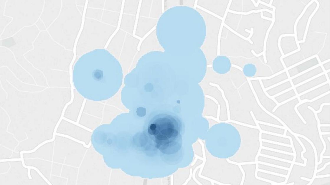
The image on the left is an image of a conventional sample survey. The image on the right is an image of partially extracting a smartphone in the radio wave area of free Wi-Fi (Source: Kokusai Kogyo) [Click the image to enlarge]Therefore, Kokusai Kogyo and Yokohama City University estimated the radio wave range of Wi-Fi access points. We confirmed the range to which the smartphone can be connected, the sample size obtained from it, and the overlap of the ranges. After that, we made it possible to calculate the population density for each 1m mesh.
Kokusai Kogyo currently handles human flow data on a 125m mesh. Until now, the collected data was handled in the same line regardless of whether the radio wave area coverage of the free Wi-Fi access point in the mesh was 1% or 99%.
On the other hand, if evaluation with a 1m mesh becomes possible, the range of radio waves can be known. Therefore, the reliability of the acquired data is higher.
"When we use 125m mesh human flow data as a product, we can now use highly reliable data and low-reliability data for different purposes." Takeshi Watanabe, Chief of the Platform Group, LBS Sensing Division, Kokusai Kogyo, said:
The light blue circle is the radio wave area of the free Wi-Fi access point. Since it is now possible to add shades with a mesh of every 1 m, it shows that the population density is high (darkened) near the road where people are moving (Source: Kokusai Kogyo) [Click the image to enlarge display]